Deep Encounters – a multifaceted mapping of a small piece of land
A year-long Walking the Land project initiated by Janette Kerr.
‘Deep Encounters is a multifaceted mapping of a small piece of land involving artists working in different areas/location. At its centre is the perception of a space in a much more intricate way than normal.’
(Janette Kerr, 2025)
Read more about the project and artists here. Participating artists: Zoë Ashbrook , Ruth Broadbent, Alison Berrett, Marlene Creates, Sara Dudman, Tamsin Grainger, Melinda Hunt, Richard Keating, Janette Kerr, Rachel McDonnell, Valerie Coffin Price, Amanda Steer, Sally Stenton, Molly Wagner.
A Deep Mapping project
“The lure of the local is the pull of place that operates on each of us … the geographical component of the psychological need to belong somewhere, one antidote to a prevailing alienation.” Lucy Lippard.
Place cannot exist independently from the human, it is a product of many layers of interaction between people and environment; something we make and remake in our imagination, constructing centres, peripheries and boundaries over time as we do so.
For many people walking in everyday, local landscape, it is a gateway into the reality of wider landscape change, even a potential first step in caring and uncovering solutions.We see this as an exercise in deep mapping; an intensive look at a particular place that might include geography, history, and ecology. Some call the approach ‘vertical travel writing’, while archaeologist Michael Shanks compares it to the eclectic approaches of 18th- early 19thcentury antiquarian topographers, or the psycho-geographic excursions of the early Situationists.
‘…..Places are not stable; they mean different things to different people – even different things at different times. The deep map recognises the slippery identity of place, and seeks to visualise the multiple identities that go towards constructing the human experience of place’. https://wp.lancs.ac.uk/lakesdeepmap/the-project/gis-deep-mapping/
We increasingly need to work in “the curious space between wonder and thought” a space where….“there is no single Disciplinary (in an academic sense) voice” (geographers Stephan Harrison, Steve Pile, Nigel Thrift), …. the: “space–between representation and reality, language and life, category and experience” (feminist philosopher Geraldine Finn).. (see https://www.iainbiggs.co.uk/2014/10/deep-mapping-a-partial-view/)
Boundary Line - A small patch of woodland....
The project begins with each artist walking the perimeter of their selected area, tracing an outline, recording over time what it contains using photos, words, drawings, maps, sound; engaging with landscape in deep and intricate ways to consider the perception of land as a living environment and the sensory experience of moving through it.
Throughout the year I’ll be regularly spending time with this small patch of woodland, documenting my observations and creative responses to what I encounter.
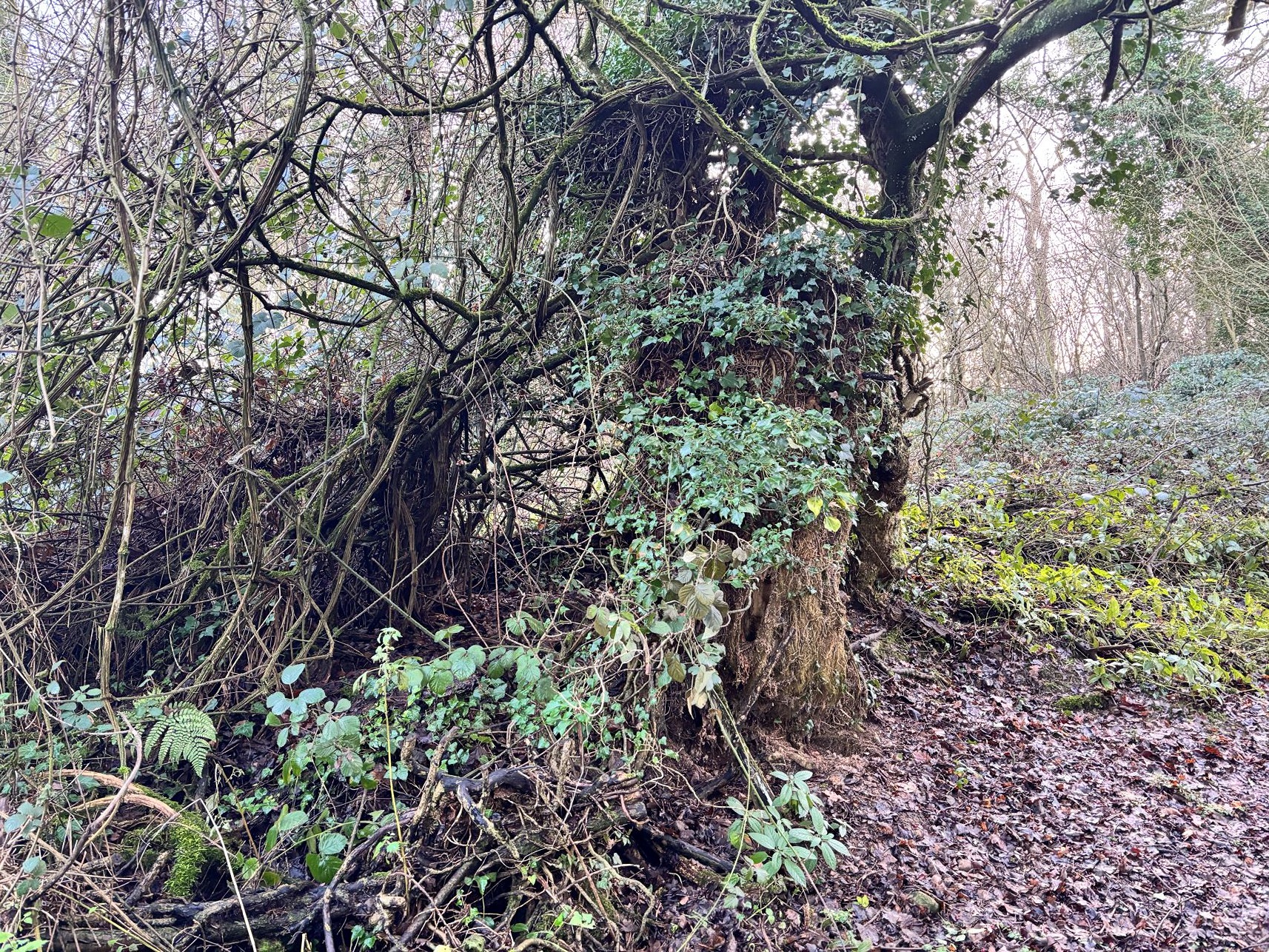
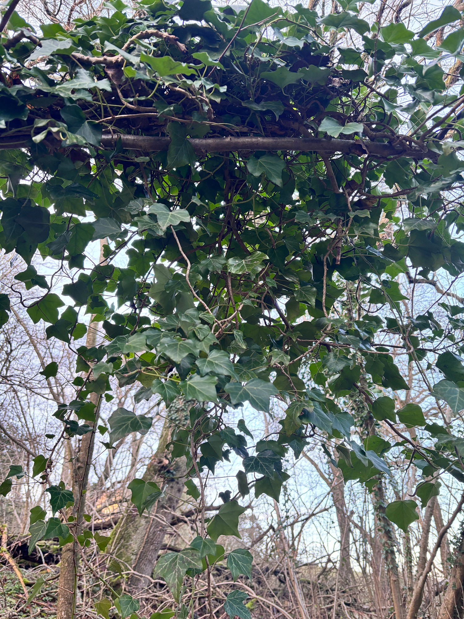
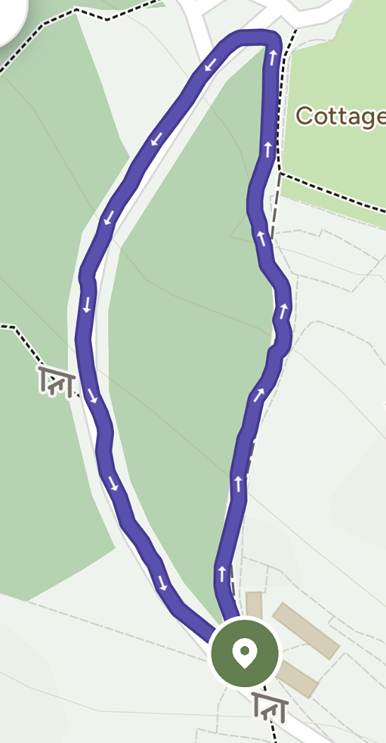
Never a destination but rather a passing point as part of longer walks, this small patch of woodland landscape, nestled on the steep incline close to the top of Chosen Hill, has repeatedly captured my attention. For many years I’ve walked along the fringes, often pausing to photograph the seasonally dominant plant life and sculptural skeletal remains of entangled ivy overgrowth, decaying tree stumps and long fallen branches now home to dense mounds of lush moss, gloriously coloured lichen and trailing foliage. With no footpaths this is not a space that makes closer investigation easy. A man made boundary line separates it from the wider woodland and encircle the site; a narrow road on one side and connecting footpath track along the other creating a route of approximately 565 paces. I’ve wondered what lies much deeper within this space which forms part of a much wider ancient woodland and site of historical significance.
Embedded within
My little patch of woodland sits within much larger Woodland Trust site forming part of Chosen Hill's rich history of human influence. The remains of an Iron Age Hillfort are now buried beneath the road, reservoirs and woodland floor. Parts of St. Bartholomew’s Church date back to 12th Century and Roman steps close by. The temporality of these ancient histories and close proximity makes the woodland space I plan to explore all the more appealing to investigate. I will continue to research the history of the site alongside an evolving process of sensory exploration through walking, drawing, collecting, documenting and making.

Habitat
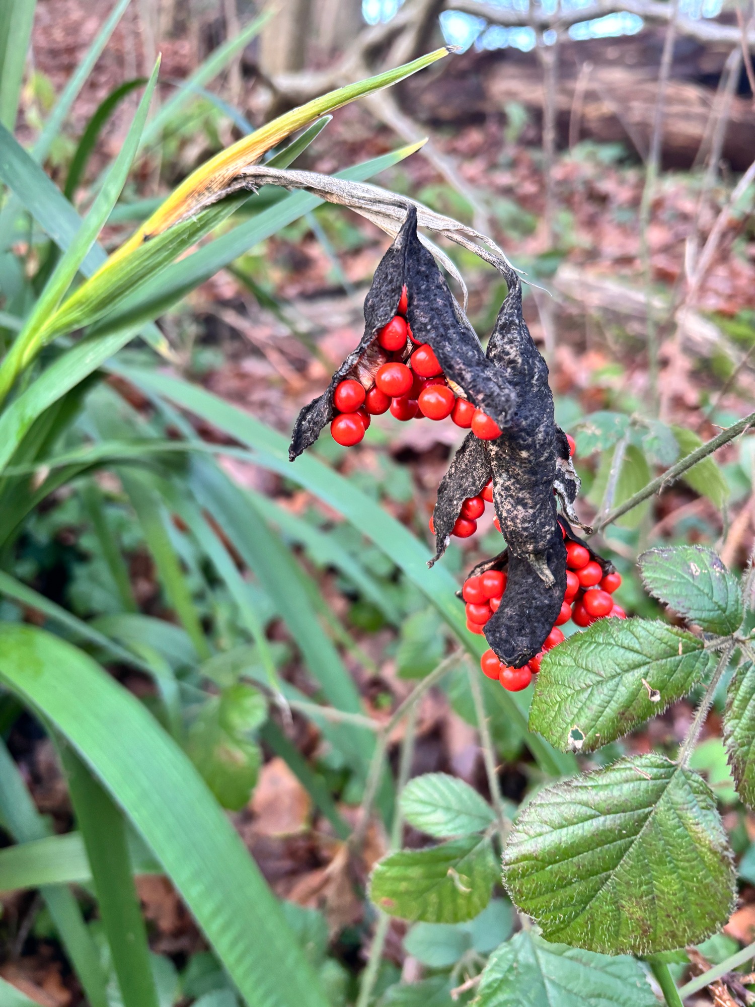
Geologically, the hill is on one of outliers of the Cotswold scarp. The Woodland Trust Public Management Plan provides a great source of information. The hill has been cleared at various times in its history via quarrying, encampments and farming, with various stages of regenerating woodland and scrub. The occasional mature and remnant fragments of ancient woodland characteristics exist in old hedgerows and banks. My little patch forms part of the wider Secondary Woodland that dominates and is said to include oak, ash, hazel and field maple. Also growing are hawthorn, blackthorn, crab apple, wild cherry and holly and Walnut. The reserve is also known for its spring flowering of bluebell, together with archangel, wood anemone and dog-violet and pyramidal orchid. I shall seek to identify and document as many plant species as I can as part of my project research.

Chosen Hill History
As well as regularly walking to my little woodland patch I have spent time researching online - I've been thrilled by some of my findings. Snapshots of information relating to Chosen Hill in general but which help create a picture in my mind and a deeper understanding of the histories that my little patch of woodland connects with. The people who have left their marks and influenced the way it appears to me now.
The site of an Iron Age Hill fort known as Churchdown Hill Camp is now buried below the main reservoir. The present church is Norman in foundation, with the nave being the main surviving part from this era. Roger du Pont L’Eveque, Archbishop of York from 1154 to 1181, is thought to have been the builder in about 1175 AD. Archbishop Roger was contemporary with Thomas Becket, Archbishop of Canterbury, and there was much rivalry between these two primates. It was extended in medieval 13th Century. Parts of the early brickwork can be seen along with 19th century graffiti engravings on the outside wall.
The Churchdown Miracle - There is apparently a stained-glass window in Canterbury Cathedral referring to The Churchdown Miracle story. A miracle attributed to Saint Thomas Becket.
Herbert Howells - Chosen Hill was a favourite place for inspiration of the early twentieth-century composers Ivor Gurney and Herbert Howells - became close friends while studying at Gloucester Cathedral, going on long walks through the Gloucestershire countryside discussing their shared love of music and English literature.
Direct inspiration for Howells' 1916 'Chosen Tune' Piano Quartet in A minor - “To Chosen Hill and Ivor Gurney who knows it...” It had special significance for Howells throughout his life, and the piece itself was written as a wedding present for his wife, Dorothy.
Ivor Gurney - poetic connection to Churchdown Hill is subtle but deeply felt. While he didn’t always name the hill directly, its presence permeates several poems through vivid Gloucestershire imagery and emotional longing for home.
Iron Age Hillfort
It was not until 1821 that any noted expert suggested there was a hill fort on Churchdown Hill. The line of an ancient rampart and ditch extending from the hilltop away from the churchyard was mooted as suggestive of a Hill Camp.
Three very large covered reservoirs were built within the site - later some new pipes were needed and so in 1972 trenches were being dug to the Southwest and they began to find ox and sheep bones burnt clay and charcoal and reported the finds to The Gloucester and District Archaeological Research Group who considered that an investigation was paramount - more finds were made (pottery sherds etc) resulted in the site being declared an Iron Age hill fort (1977) - it was thought that the construction of the fort resembled closely other forts at Bredon Hill and Sutton Walls.
Domesday Book
I was very excited to find the name Churchdown is first attested in the Domesday Book of 1086, as Circesdvne, a settlement in the hundred of Dudstone and the county of Gloucestershire. It had a recorded population of 30 households in 1086, putting it in the largest 40% of settlements recorded in Domesday. (Image opposite provided courtesy of Professor John Palmer, George Slater and opendomesday.org.)
The name Chyrchesdoun starts to appear from the twelfth century. Scholars agree that the second element of the name is the Old English word dūn ("hill"). Traditionally, the first element has been taken to be a Brittonic word corresponding to Proto-Welsh crüc ("hillock"), in which case the name is tautological: English-speakers encountered a hill known in Brittonic as crüc, took it as a place-name, and added their own word for "hill". However, the 2004 Cambridge Dictionary of English Place-Names argues that "the parish church is on top of a hill which does not have the distinctive profile of the kind of hill called cryc from PrW crüc", arguing instead that the name comes from a masculine variant of the Old English feminine noun cirice ("church") and thus that it meant "church's hill".
